As a surveyor and military man, George Washington created and used maps throughout his life. Access our growing collection of maps pertaining to Washington, Mount Vernon, and the world he lived in.

ARGO: American Revolutionary Geographies Online
ARGO is an exciting new project led by the Washington Library and the Leventhal Map and Education Center at the Boston Public Library. The site, currently in public beta, will collate digitized maps of North America made between 1740-1800 in a single, user-friendly portal alongside interpretive essays, curated collections, interactives, teaching materials and more.
ExploreHow did George Washington help create the first American atlas?
George Washington loved maps. He made maps and collected maps. In this short episode, come see one of George Washington's prized atlases and learn the story behind his contribution to the understanding of early American geography.

Podcast: Secrets of Washington's Archives
Learn more about this object, and others, in Secrets of Washington's Archives, a video and podcast series about the books, papers, and maps that belonged to George Washington.
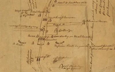
Mount Vernon Maps
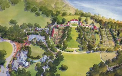
Mount Vernon Estate Map
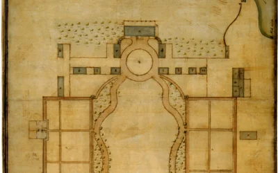
The Samuel Vaughan Plan
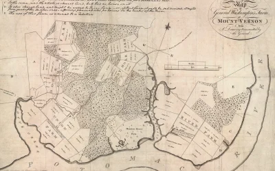
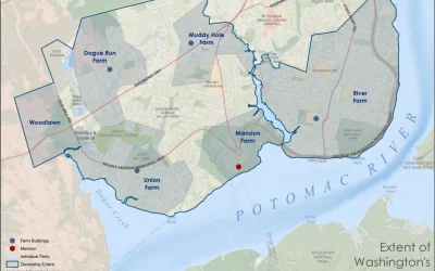
Washington's Mount Vernon Farms
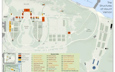
The Structures of Mount Vernon
Extent of Washington's 1793 Mount Vernon Land Holdings
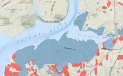
Land Status of the Maryland Viewshed
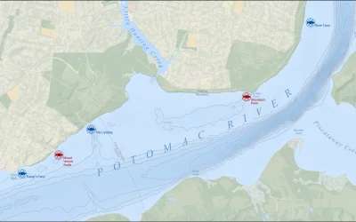
Washington's Five Fisheries
Washington the Surveyor
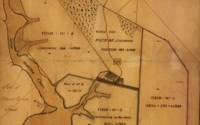
Little Hunting Creek Map
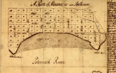
A plan of Alexandria, now Belhaven.
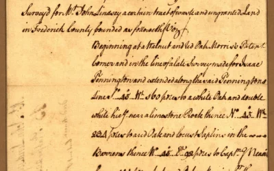
Survey for John Lindsey of 223 acres in Frederick County, Va
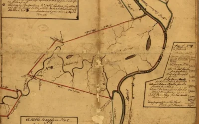
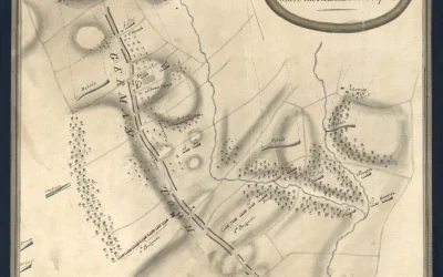
The Kanawha Tracts
French & Indian War
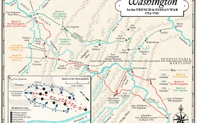
Washington in the French & Indian War
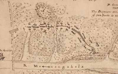
Battle of the Monongahela 1755
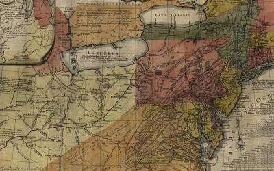
General Map of the Middle British Colonies in 1755
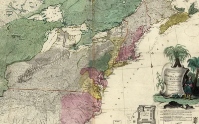
Theatrum belli in America Septentrionali.
Revolutionary War Maps
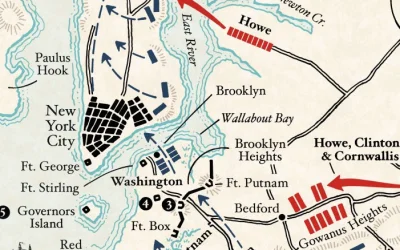
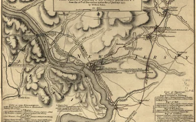
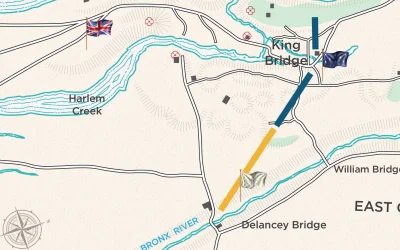
Map: The 1776 New York Campaign
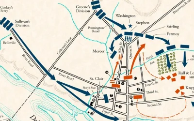
Map: Battle of Trenton
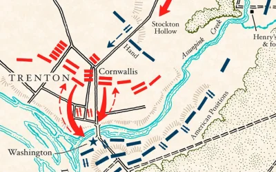
Map: Battle of Second Trenton
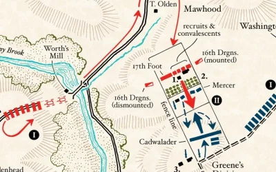
Map: The Battle of Princeton, Phases I & II
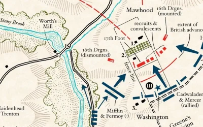
Map: Battle of Princeton, Phases III and IV
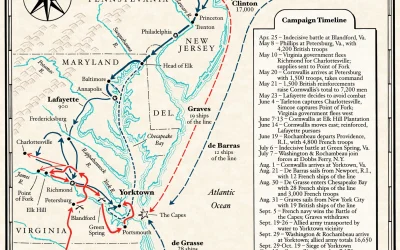
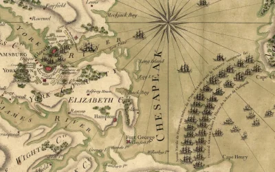
Map: The Yorktown Campaign of 1781
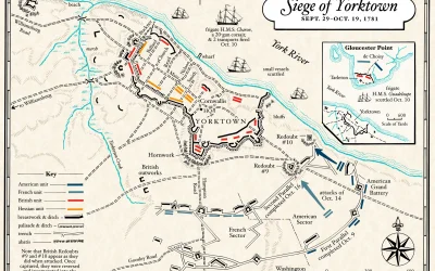
Map: The Siege of Yorktown
Boston, its environs and harbor, with the rebels works raised against that town in 1775
The Battle of Trenton
Plan of Princeton, Dec. 31, 1776.
The Battle of Germantown
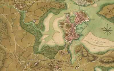
The Battle of Yorktown
The Reconnaissance of New York in July 1781
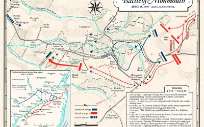
Map: Battle of Monmouth - Morning
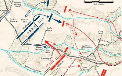
Map: Battle of Monmouth - Afternoon