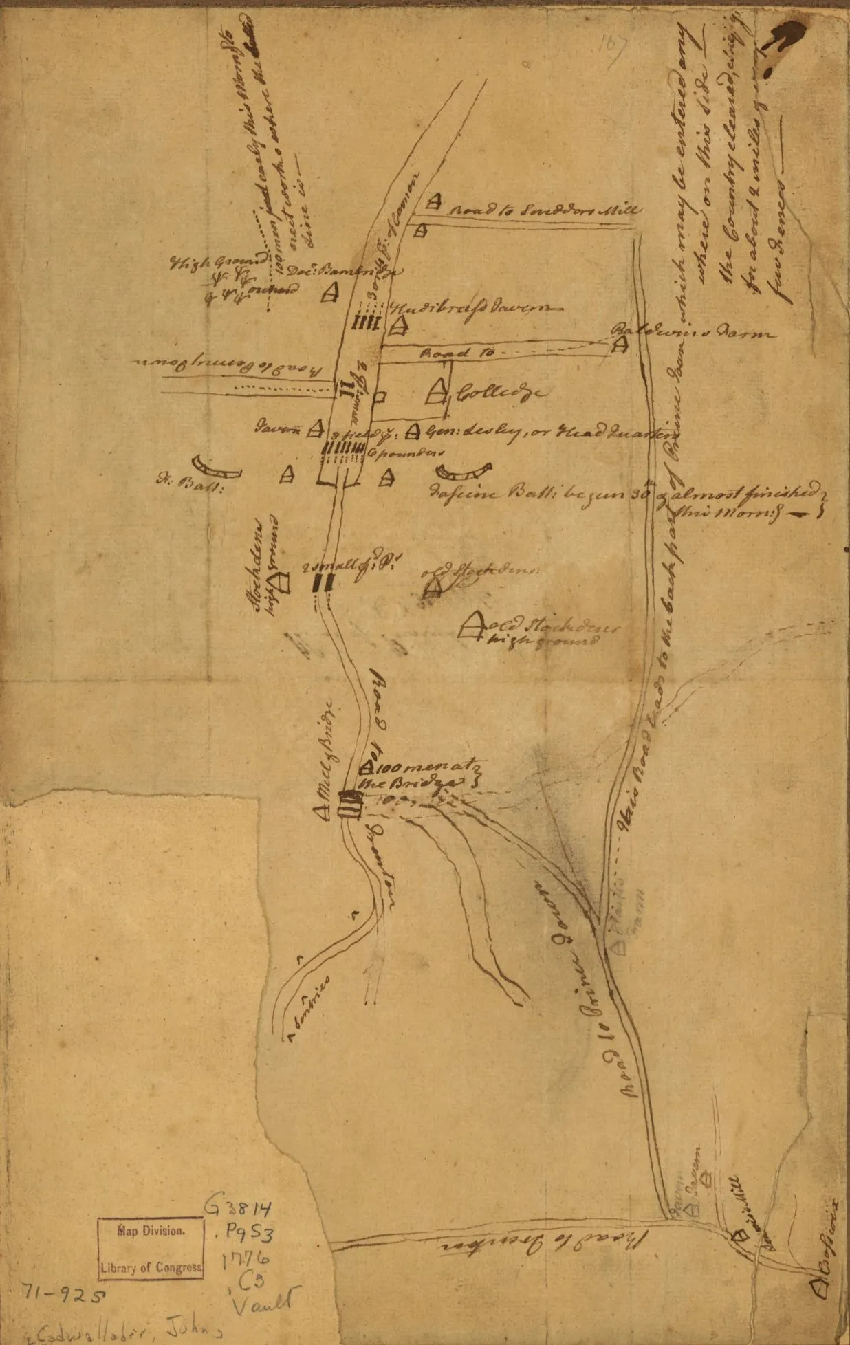
George Washington received this hand-drawn map as he was marching north from Trenton to attack the British positions around Princeton, New Jersey. Drawn by John Cadwalader, the information reportedly was derived by an unnamed Princeton student who had observed the British positions around the town. The intelligence contained in this map helped shape Washington's plan of attack.
Source: Library of Congress Maps Division http://lccn.loc.gov/gm71000925